
Ascutney History

Glympses of Ascutney, 1905
Foreward
The object of getting out this brochure is two fold; first to furnish a reliable guide for those climbing Mount Ascutney who are unacquainted with the views from the summit; and second to create an interest in the Ascutney Mountain Club, which has for its mission the preservation of the Summit House and the roads leading thereto.
As the proceeds from the sale of the book will be expended upon necessary repairs to the house and road, it is hoped that all the mountain lovers will buy copies for themselves and their friends, thus contributing in two ways for their own and others pleasure.
Many unique and picturesque views of Ascutney have escaped the cameras of the enthusiastic photographers tramping up the mountain side but a few typical ones are offered here. If this edition is only quickly exhausted we promise a better one for 1906.
Frank H. Clark
Windsor, VT, August 16, 1905
Picture
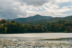
Ascutney and Windsor from Cornish Hills
Picture
The Falls on Mountain Brook
Mount Ascutney
Beyond the mountains- beyond the line of blue!
My soul enraptured with the Heavenly view;
Would plume its wings for the celestial flight,
And swift as arrow see that world of light,
Drawn by visions of the loved ones there,
Where sweet-voiced welcome seems to fill the air.
Pg 6
Picture
Ascutney from the Crown Point Road, Springfield Hammond
Perhaps many of us do not feel the same cheerfulness of spirit that inspired the poet to pen the foregoing beautiful line, but to those of us who have climbed Mount Ascutney and feasted our eyes on the charming vistas spread out on every hand, there comes a feeling akin to it which lifts us out of the everyday life of this world to that of the world beyond.
Ever since the Indian hunted his game around the foothills,
Pg 7
Picture
Summit House of 1858
and guided this canoe up and down the picturesque Connecticut, Ascutney or Tri-mountain has been a familiar object to the people of this region. It was so named from the three principal heights or ridges which radiate from the summit and are so plainly seed from the east side of the mountain.

Page 8 & 9
A group on Ascutney, Labor Day September 5, 1904
Pg 10&11
Picture
The Road Around Windsor Rock
kind of house erected; tradition says, however, that a house and road were built, and the latter has been substantially followed by the later paths.
The house has been gone for many years and few repairs were made on the road until 1858, when, after a survey by D. C. Linsley the previous year, the road was rebuilt over practically the same route as in 1825 and a comfortable stone house was erected, fourteen by twenty feet in size, with a stone fireplace in one end and an iron roof held in place by stout poles across the top.
In the Vermont Journal published at Windsor by L.J. McIndoe, and extended account of the successful opening and dedication of the “Linsley Road” and of the “Ascutney Summit House” on September 4 1858, is given. A heavy rain the night before kept away many who had planned to go, but, notwithstanding this drawback, over three hundred persons attended and enjoyed the dinner, the interesting speeches and the music by the Windsor Cornet Band.
After the great fire in 1883 which devastated a large portion of the summit, mountain climbing became a tedious task because so many partly burned trees had fallen across the pathway. The fact that the Summit House had been dismantled and almost torn down by thoughtless travelers so that there was no shelter after one reached the top, also discouraged excursions.
In the fall of 1903, Messrs. Henry S. Wardner and Geo. A. Duncati surveyed the old road, laying out a new route in several places near the summit but following for the most part the old pathway. Several hundred dollars in cash and labor were contributed and the road was made possible for foot travelers and horseback riders.
The trail starts near Allen Dudley’s farm house, leading through a lane and pasture until the woods are reached, then following a valley for about a half the distance until a ridge is gained when it winds the remainder of the way over rocks and ledges to the summit. About two thirds of the way up is a fine spring where the wayfarer may quench his thirst and take a needed rest.
There are several ways to get up the mountain, a pathway on the Brownsville side being used by parties from that section and (pg 14&15) being in fairly good condition. This trail is about the same length as the “Linsley Road”, three miles, and the start is made from Herbert Dunn’s just above the village, the first mile being quite steep up to the first ridge, when it becomes less steep and so continues until it is merged in the “Linsley Road” near the summit. There is an old wood road on the Weathersfield side of the mountain which extends nearly to the top and is used by many in making the trip. There are also paths from the Ascutneyville side which lead up over blueberry ridge, and several old wood roads used by lumbermen, may be used for some distance up the mountain on the Windsor side, by those who are not looking for a smooth pathway.
The stone house was rebuilt on the site of the old one, this being accomplished before the winter season. It was deemed advisable not to have a celebration signaling the completion of the new house and the rejuvenated path that fall, and was not until Labor Day, September 5, 1904 that they were dedicated with appropriate exercises. On the date some seven hundred people climbed Mount Ascutney and helped make the day the most memorable in its history. A luncheon was served, after which there was a flag raising by fifteen young boys and girls, short speeches, the singing of patriotic songs and a band concert by the Windsor Military Band.
Nearly all those present joined the Ascutney Mountain Club, signed the register and agreed to help preserve the house, flag and any other property that might be erected. Thirteen different states and two kingdoms were represented. The oldest climbers to make the trip were Charles Silver of Brownsville, VT, aged eighty years, and Dr. G. W. Hunt of Cornish Flat, NH, who celebrated his seventy-fifth birthday and fifty years of practice as a physician at the same time. J.H. Hammond and Galen C. Waite, both of Brownsville, were the only ones present attended the dedication in 1858.
The present road is in good condition so that if the traveler takes plenty of time the journey may be made without fatigue. The thick woods hide any view of the outside world until the top is nearly gained when, through an opening, the Village of
page 16
Picture
Ascutney from Hartland Ruggles
Windsor is seen, the most prominent object being the white walls of the Vermont State prison, and, further north the Connecticut river and Hart’s Island, opposite the town of Hartland. Just before the summit is reached two huge boulders rise up, almost blocking the further progress towards the top. The path winds around the right hand mass to its top called “Windsor Rock”, because the best view of the Village is obtained from that point.
page 17
Picture
The present Summit House and U.S. Signal, Looking North
Far away in the north, near the Canada line, Jay Peak may be seen on a clear day. A little nearer, to the northeast, Moosilauke, Mt. Washington and the Presidential range and Kearsage-North, are visible, and almost in line with the latter, is Cardigan Mountain, while a little north of east, Gunstock Mountain comes in sight and Croydon Mountain much nearer, may be recognized
page 18
Picture
Summit House of 1903
By its long, slender shape which breaks off abruptly on the southerly side. Next in order are Kearsarge-South, Unkonoonae and the majestic Monadnock far to the southeast.
From “Windsor Rock” to the United States Signal Station, erected by members of the U.S. Coast Geodetic Survey in 1901, and to the summit house near by, is only a short distance, and here the traveler may obtain some more magnificent views from the ledges in front of the house. The three ridges stretch away almost to the Connecticut river, which looks like a silver band among the hills. The line of the railroad may be followed, the trains going up and down looking about as large as the toy engines and cars with which children play. High Bridge, over Sugar river and Claremont Village are in full view, and its principal streets may be discerned without the aid of a glass. This village as well as Windsor and Bellows Falls afford a grand spectacle to those fortunate enough to stay overnight, when the hundreds of electric lights twinkle in the darkness like stars.
Towards the west Lake Sunapee glistens in the sunlight, and on a very clear day, of which there are not more than half a dozen during the season, the Atlantic Ocean is visible near Portsmouth as one looks between Kearsarge-South and Unkonoonue.
On the northwest side of the mountain only a short way from the Summit House is “Brownsville Rock”, and from this vantage point one gets a fine view of that quiet village spread out at its base and beyond is unfolded as charming a picture of rural beauty as can be found anywhere, the prevailing color, green, with variegated patches fo cultivate land, pasture and forest, with the roads and streams winding in all directions, and with farm buildings dotting the landscape here and there, make a scene never to be forgotten. And if perchance the enthusiastic mountain climber finds himself on this rock during the early autumn when the frosts have painted the foliage with the bright red, yellow and brown tints so common at that season, he will feel doubly repaid for the toil and exertion necessary to get another view of this ever changing picture. Under this rock is a spring where a small supply of water may be obtained and the “cave” which is a source of wonder and delight to those small enough to crawl through it. Jay Peak is visible from this point, while farther to the west Mount Mansfield and Camel’s Hump, the highest points in Vermont (21), are plainly seen. Following the ridge of the Green Mountains with the eye, towards the west, Pico and Killington Peaks rise above the neighboring mountains in sharp outline, while beyond, the Adirondack Mountains may be seen on a clear day, and to the southwest Mt. Equinox and Haystack are the most prominent elevations to be seen. The lesser elevation, Mt. Tom and Mt. Pisgah in Woodstock, Mt. Moses in Reading, Ludlow mountain in Ludlow and Little Ascutney and Hawk’s Mountain in Weathersfield may be located by those familiar with that section of the country.
On the Weathersfield end of the ridge leading from the Summit House there is quite a growth of pines and other trees and one has to clamber over rocks and trees to an open space in order to obtain a view there.
Off to the right hand are Downer’s famous hostelry and the Village of Amsden nearby, while to the South that familiar landmark, the old brick church at Weathersfield Center, is plainly seen.
Beyond, a small portion of Springfield Village may be made out, while farther to the east the big bend in the Connecticut river, at Weathersfield Bow, and the course of the river to Bellows Falls and beyond may be followed.
As was suggested last summer, a lodge of logs should be erected on the Weathersfield side which could be used by a camping party for shelter when more room was needed than the Summit House afforded.
The isolated position of this mountain peak and its height, 3160 feet, make it an ideal spot for sightseers, and we prophesy that an ever increasing number of visitors will wend their way to the top every year.